


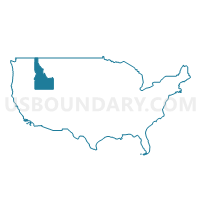
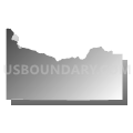
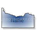
Twin Falls & Cassia Counties--Twin Falls City PUMA, Idaho
About
Outline

Summary
| Unique Area Identifier | 192779 |
| Name | Twin Falls & Cassia Counties--Twin Falls City PUMA |
| State | Idaho |
| Area (square miles) | 4,508.61 |
| Land Area (square miles) | 4,486.29 |
| Water Area (square miles) | 22.31 |
| % of Land Area | 99.51 |
| % of Water Area | 0.49 |
| Latitude of the Internal Point | 42.31317850 |
| Longtitude of the Internal Point | -114.07858490 |
Maps

Graphs
Select a template below for downloading or customizing gragh for Twin Falls & Cassia Counties--Twin Falls City PUMA, Idaho


Neighbors
Neighoring Public Use Microdata Area (by Name) Neighboring Public Use Microdata Area on the Map
- Canyon (South) & Owyhee Counties--Caldwell & Nampa (South & West) Cities PUMA, ID
- Elmore, Jerome, Blaine, Minidoka, Gooding, Lincoln & Camas Counties PUMA, ID
- Rural Nevada PUMA, NV
- Southeast Idaho--Pocatello, Chubbuck Cities & Fort Hall Reservation PUMA, ID
- Tooele & Box Elder Counties PUMA, UT
Top 10 Neighboring County (by Population) Neighboring County on the Map
- Twin Falls County, ID (77,230)
- Box Elder County, UT (49,975)
- Elko County, NV (48,818)
- Elmore County, ID (27,038)
- Cassia County, ID (22,952)
- Jerome County, ID (22,374)
- Blaine County, ID (21,376)
- Minidoka County, ID (20,069)
- Gooding County, ID (15,464)
- Owyhee County, ID (11,526)
Top 10 Neighboring County Subdivision (by Population) Neighboring County Subdivision on the Map
- Twin Falls CCD, Twin Falls County, ID (50,967)
- Jerome CCD, Jerome County, ID (19,206)
- Burley CCD, Cassia County, ID (14,177)
- Rupert CCD, Minidoka County, ID (9,907)
- Buhl CCD, Twin Falls County, ID (9,612)
- Kimberly CCD, Twin Falls County, ID (7,299)
- American Falls CCD, Power County, ID (6,166)
- Wendell CCD, Gooding County, ID (5,977)
- Filer CCD, Twin Falls County, ID (5,523)
- Heyburn CCD, Minidoka County, ID (5,408)
Top 10 Neighboring Place (by Population) Neighboring Place on the Map
- Twin Falls city, ID (44,125)
- Burley city, ID (10,345)
- Buhl city, ID (4,122)
- Kimberly city, ID (3,264)
- Filer city, ID (2,508)
- Jackpot CDP, NV (1,195)
- Hansen city, ID (1,144)
- Oakley city, ID (763)
- Declo city, ID (343)
- Hollister city, ID (272)
Top 10 Neighboring Unified School District (by Population) Neighboring Unified School District on the Map
- Twin Falls School District 411, ID (51,059)
- Box Elder School District, UT (49,975)
- Elko County School District, NV (48,818)
- Cassia County Joint School District 151, ID (22,454)
- Blaine County School District 61, ID (21,376)
- Minidoka County Joint School District 331, ID (20,877)
- Jerome Joint School District 261, ID (19,389)
- Buhl Joint School District 412, ID (8,666)
- American Falls Joint School District 381, ID (7,200)
- Filer School District 413, ID (6,845)
Top 10 Neighboring State Legislative District Lower Chamber (by Population) Neighboring State Legislative District Lower Chamber on the Map
- Assembly District 33, NV (51,407)
- State House District 23, ID (45,710)
- State House District 25, ID (43,165)
- State House District 24, ID (43,046)
- State House District 26, ID (42,443)
- State House District 27, ID (38,757)
- State House District 1, UT (34,122)
- State House District 22, ID (34,066)
Top 10 Neighboring State Legislative District Upper Chamber (by Population) Neighboring State Legislative District Upper Chamber on the Map
- State Senate District 17, UT (102,922)
- Rural Nevada Senatorial District, NV (97,335)
- State Senate District 23, ID (45,710)
- State Senate District 25, ID (43,165)
- State Senate District 24, ID (43,046)
- State Senate District 26, ID (42,443)
- State Senate District 27, ID (38,757)
- State Senate District 22, ID (34,066)
Top 10 Neighboring 111th Congressional District (by Population) Neighboring 111th Congressional District on the Map
- Congressional District 1, UT (906,660)
- Congressional District 1, ID (841,930)
- Congressional District 2, NV (836,562)
- Congressional District 2, ID (725,652)
Top 10 Neighboring Census Tract (by Population) Neighboring Census Tract on the Map
- Census Tract 7, Twin Falls County, ID (10,913)
- Census Tract 10, Twin Falls County, ID (8,818)
- Census Tract 9602, Gooding County, ID (7,990)
- Census Tract 12, Twin Falls County, ID (7,665)
- Census Tract 9601, Gooding County, ID (7,474)
- Census Tract 13, Twin Falls County, ID (7,299)
- Census Tract 9705, Jerome County, ID (6,930)
- Census Tract 2, Twin Falls County, ID (6,346)
- Census Tract 8, Twin Falls County, ID (6,224)
- Census Tract 9602, Power County, ID (6,166)
Top 10 Neighboring 5-Digit ZIP Code Tabulation Area (by Population) Neighboring 5-Digit ZIP Code Tabulation Area on the Map
- 83301, ID (52,010)
- 83338, ID (19,782)
- 83318, ID (17,226)
- 83350, ID (12,268)
- 83316, ID (9,626)
- 83341, ID (6,491)
- 83211, ID (6,374)
- 83355, ID (5,405)
- 83328, ID (5,347)
- 83336, ID (4,951)